Day 7 – 20.09.2018 – From Zion to Bryce Canyon
After three awesome days we had to leave Zion, today’s target was Bryce Canyon, with two stops inbetween: A friend of mine, Daniel from Take A Hike, recommended Cedar Breaks National Monument. Going from there to Bryce you’ll automatically drive through Red Canyon, where we also did a small hike.
Cedar Breaks National Monument
Today we didn’t start that early, compared to the last three days it was actually quite late. Packing up everything at the tent site also takes some time. The fastest way to Cedar Breaks is going back to the I-15, another route would be to go through Zion and the Mount Carmel Tunnel, where you definetly have to wait a bit. So we took the fastest way using the Interstate.
Cedar Breaks is also known as “Mini-Bryce” because of its similarity to the actual Bryce Canyon. Both have Amphitheatres, are in the same red/orange and in both of them you’ll find Hoodoos.
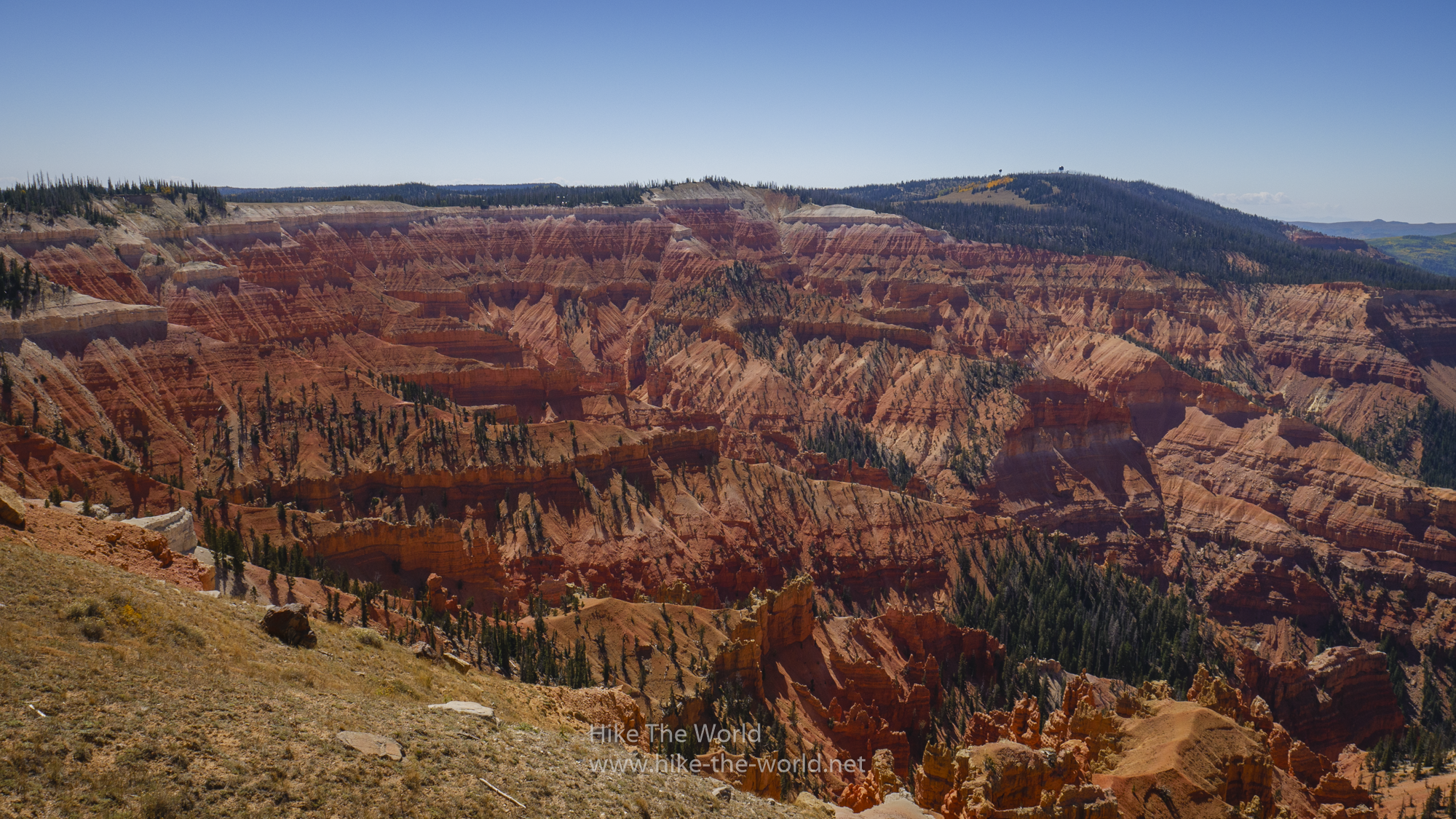
Compared to Bryce Canyon, Cedar Breaks is with 10000 feet (3000 m) above sea level an additonal 1000 feet (300 m) higher. While we had a temperature of at least 30 centigrades in Zion, there were only about 20 centigrades here at Cedar Breaks. Additionally it was quite windy.
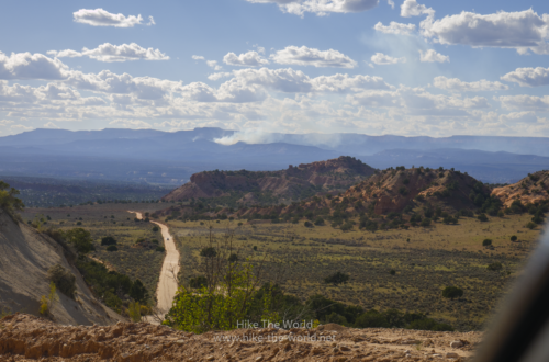
Our first stop was at the Visitor Center to get a map and overview of Cedar Breaks. From here we started with a short hike towards Spectra Point and Ramparts Overlook. Doing not too much, because of the previous day’s hike to the Subway, which took its toll.


Before actually driving to the Red Canyon, we drove to another viewpoint called Chessman Ridge. All in all it’s a nice and small park, which is worth a short visit. If you don’t have the time, go directly to Bryce Canyon, which is way bigger and offers more hikes than Cedar Breaks does.
Red Canyon
After leaving Cedar Breaks we took the direct route to Bryce. When you drive to Bryce Canyon, you’ll have to take the Scenic Byway 12, which starts here with Red Canyon and continues through the Grand Staircase up to Capitol Reef National Park. From Red Canyon to Bryce it’s still another 14 miles (22 km).
Red Rocks dominate the landscape in this area of our beautiful planet. These colors gave the name “Red Canyon”. Contrary to Cedar Breaks of Bryce Canyon, you’ll still find here more green plants, most of the time bristlecone pines or some other bushes.
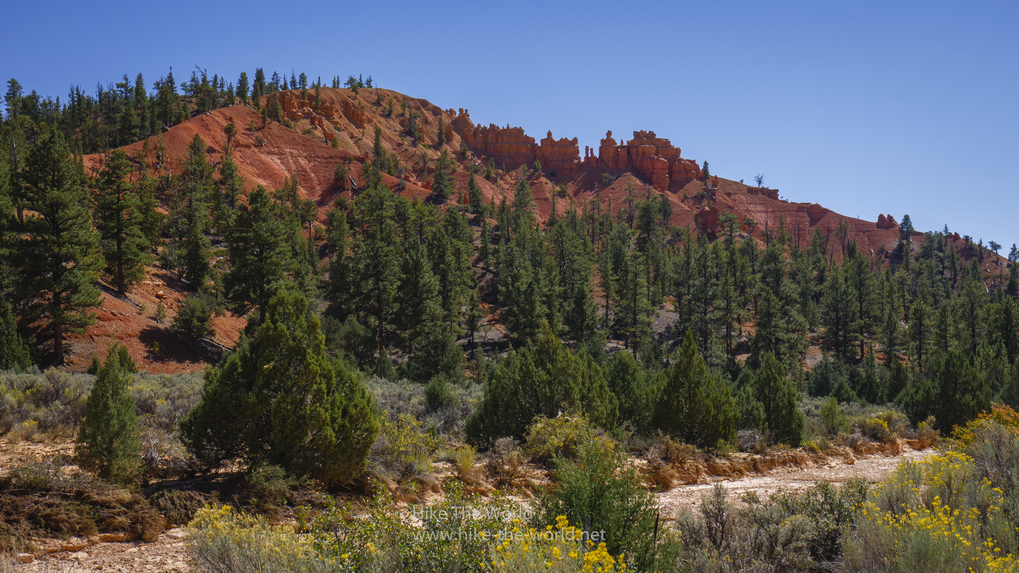
Unfortunatly our hiking boots were still wet from the Subway hike, so we only did an easy and short hike. On both sides of the street you’ll find trails. On one side is a way right next to the street where you can go to the visitor center, on the other side you can hike through the red rocks.
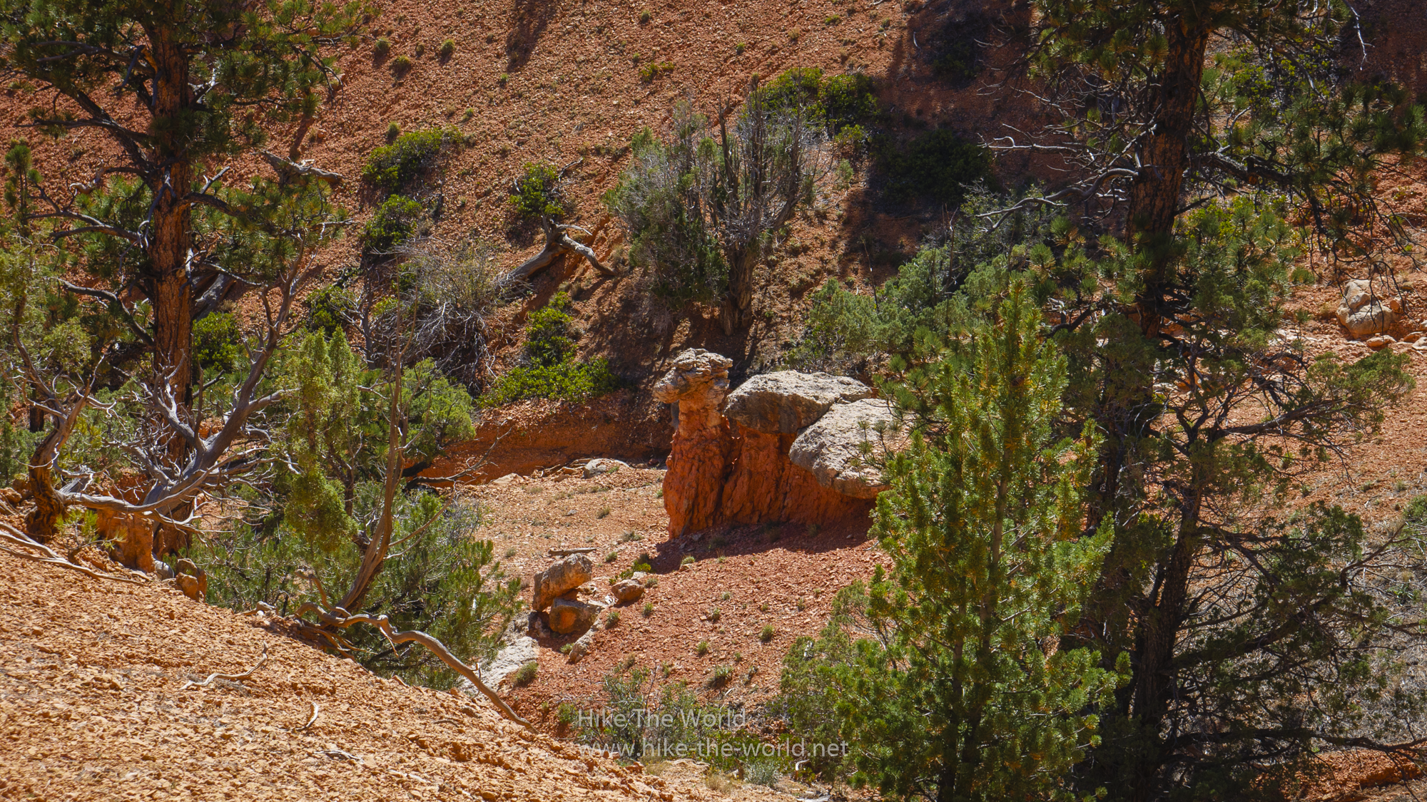
We parked our car directly on the first parking lot and went on the left side of the street through the red rocks towards the Visitor Center. In total we did three small trails: Starting on the Photo Trail and then going via Birds Eye Trail to the Hoodoo Trail. While hiking the Birds Eye Trail, you’ll walk by the Camel Overlook and indeed, with a bit of phantasy, you’ll see a stone camel.
Afterwards we stopped by the Visitor Center and went along the street back to the car. There are many more trails in this area, but we didn’t have the time to do more. All in all, you can probably cover at least a full day with hikes in the area.


Bryce Canyon
Before actually driving into Bryce, we went to the Campground first. We had reserved a Tipi at Ruby’s Inn RV Park & Campground. One year earlier I already stayed here for a couple of nights and remembered the really clean showers. The showers in the older main building aren’t that good as the ones further down on the campground, but they are still ok. I’ve seen worse.
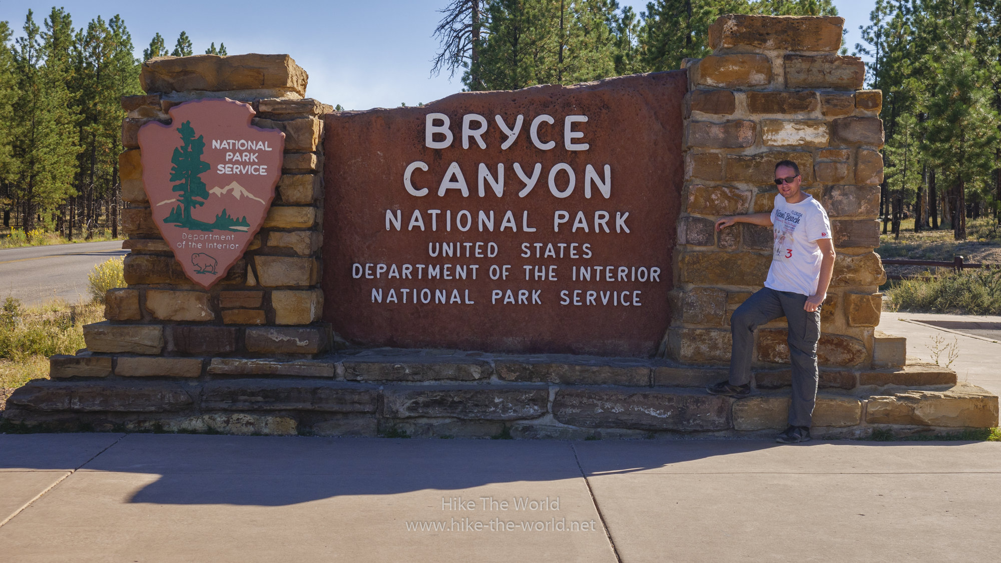
Now we finally drove into the park. Just like in Zion, Bryce also has a shuttle system in place, which is optional. Although there’s a shuttle stop directly at Ruby’s, we drove with our car to be more flexible. There’s one thing, that I need to do at (nearly) every National Park: Get a picture of the National Park Sign and me.
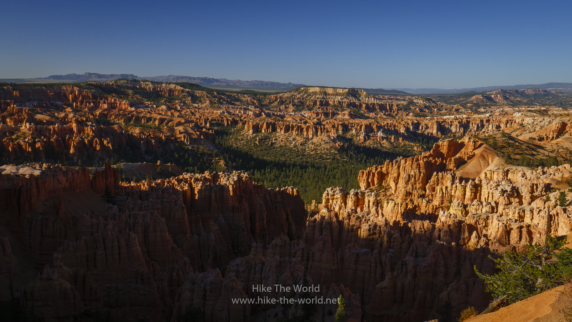
We directly drove towards Bryce Point to hike the Peekaboo Loop Trail, which I didn’t fully do in 2017. We arrived at about 6 pm and hiked down towards the Peekaboo Loop, but unfortunately we didn’t have the time to do the full trail. Nevertheless we had awesome views of Bryce and its amphitheatres.
In the autumn of 2018 we were not able to drive any further than Bryce Point, the street towards Rainbow Point was closed due to the Riggs Fire which was threatening Bryce.
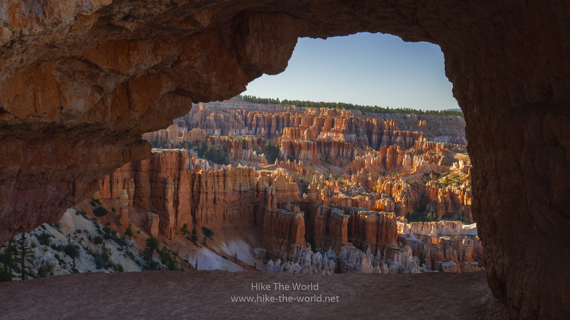
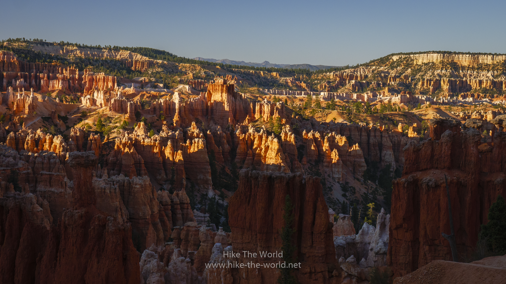
Bryce is always worth a visit, but it’s the best during sunrise or as in our case sunset. During these times of the day Bryce is really beautiful. My recommendation is to start early in the morning and leave Bryce after sunset. You’ll get really awesome photo motives, like the following:
Due to being at about 9000 feet (about 3000 meters), it gets quite cold once the sun has set, especially in the lower parts of the amphitheatre. So we only did a short part of the trail and instead drove to Sunset and Sunrise point where we hiked a bit along the rim.
Not for the last time, we met some Germans here. It doesn’t matter where in the US you go, you’ll meet Germans everywhere, especially in the National Parks.
We had a great sunset on the Rim.
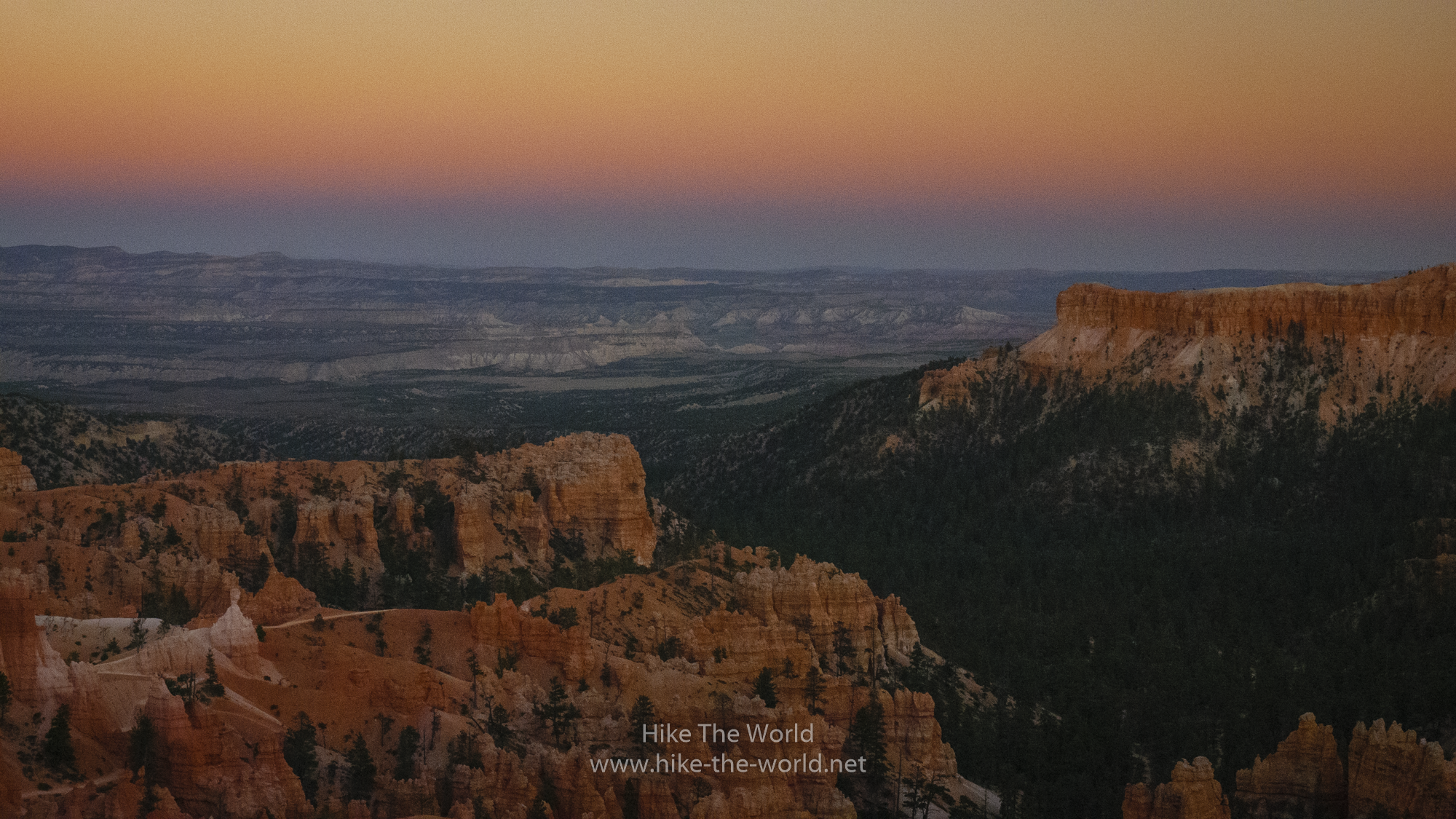
Before I show you the last photos, a couple of words about Bryce “Canyon”. A canyon is normally being shaped by a river going through many meters of rock, just like Zion or the Grand Canyon. Bryce is different. Bryce has been created by erosion and the weather formed the so called Hoodoos which are typical for Bryce. This is why the National Park Service is calling it a “natural Amphitheatre”. Bryce is on the edge of the Paunsaugunt Plateau which forms the whole area.
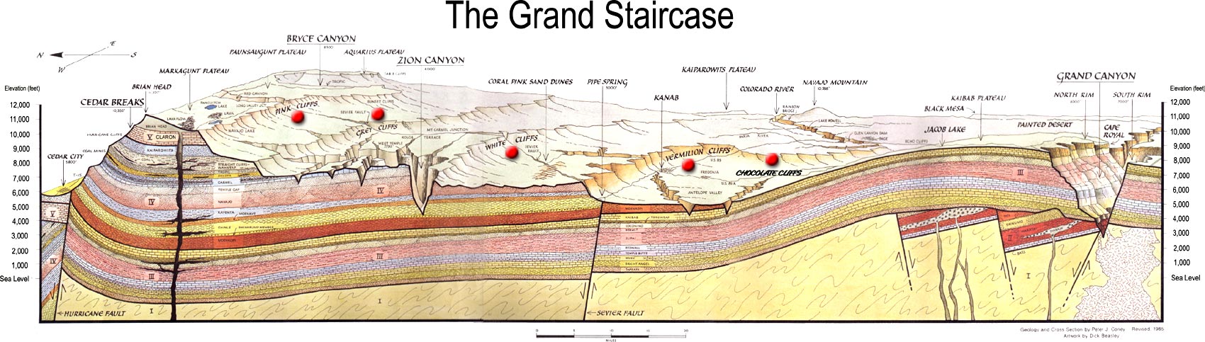
The overall area from Zion via Cedar Breaks, Bryce Canyon, Escalante to the Grand Canyon is acutally called “The Grand Staircase”. The Grand Staircase is therefore responsible for many of the great landscapes in Utah’s Southwest.


The only thing remaining was Dinner. This time we had the buffet in the nearby Ruby’s Inn, which actually seems to be the same buffet every day…


You May Also Like
Roadtrip USA 2018
Day 5 – 18.09.2019 – The Narrows in Zion NP