Day 4 – 17.09.2018 – Zion NP: East Rim Trail
After our first camping night, we had to rise quite early, as we had to be at the Zion Adventure Company already at 6 am. Today we wanted to do the East Rim Trail and the shuttle was supposed to leave at 6:15 am towards the East Entrance of Zion National Park.
The East Rim Trail is one of the longer hikes which ends in the main canyon of this park. You only have three of this kind in Zion: East Rim, West Rim Trail and the Narrows which you can hike Top Down, starting outside of the park. Without any detours, the trail is about 10.8 miles (17 km). But we added to our hike Cable mountain, an additional 6 miles (10 km). From the beginning we knew, it’s going to be a long day.
Along the East Rim Trail
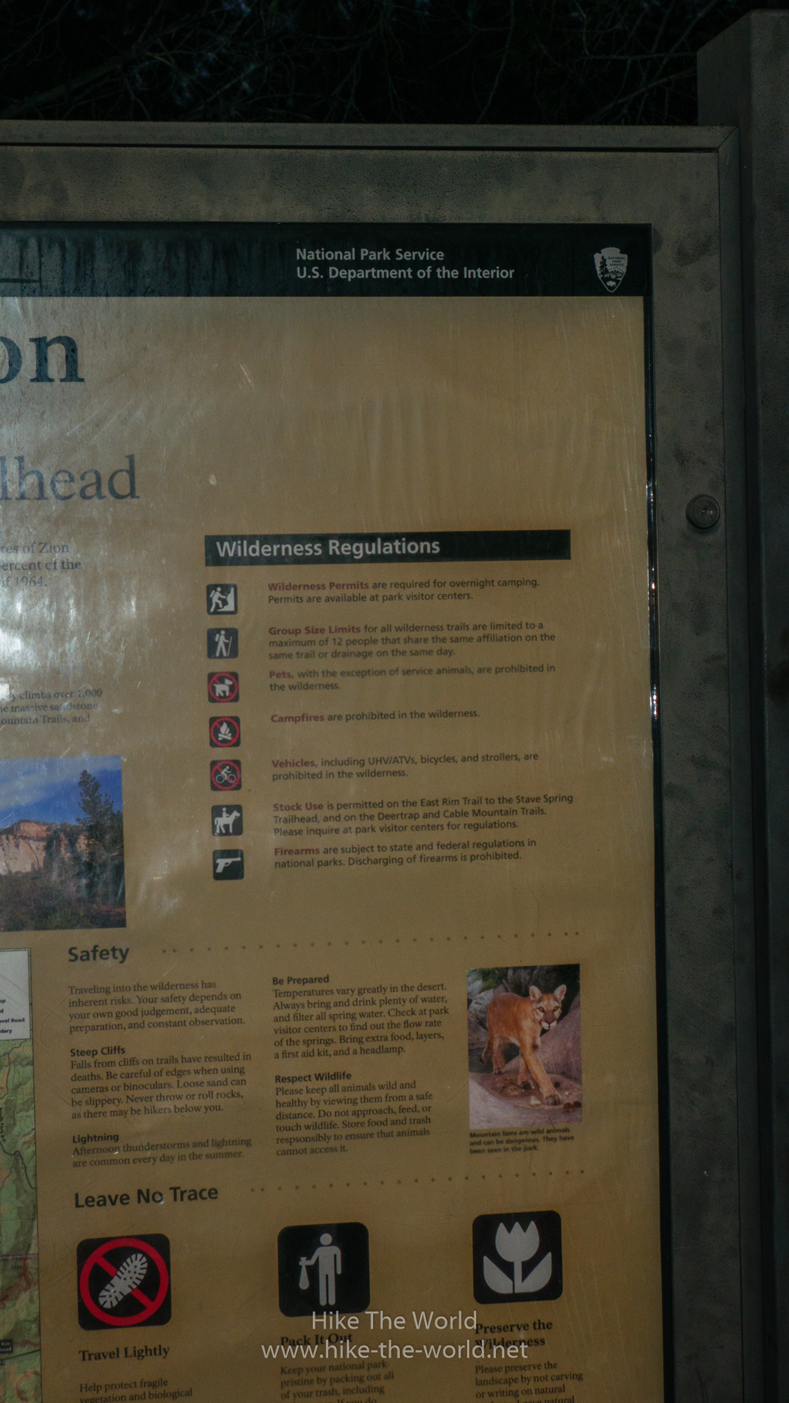
The Shuttle left on time at 6:15, we didn’t have to wait for anyone. But clever as I am, I forgot the sunscreen. A full day in the sun without sunscreen, not a good idea! But I got lucky and there were other Germans in the van who could help me out. About 30 minutes later, we arrived at the trailhead, even before sunrise. At the trailheads you usually find a sign, which informs you about the most important things, like “Leave no trace”. Do not throw your waste into the nature, take it back with you.
We actually started our hike at 7 am, still before sunrise and with only some minor daylight. So we had the chance to see sunrise at 7:15 am on the trail. But in Zion you can’t see a real sunrise, the sun starts to show behind some of the mountains. Nevertheless, it can be quite awesome, when you see the sun showing up half behind these mountain. During sunrise and in the early morning, the colors in Zion are really awesome. Zion is most beautiful during these times of day.


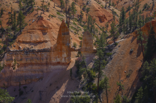
On the trail you’ll have several great views, including the Checkerboard Mesa and Jolley Gulch. Seeing this early in the morning, you realize that getting up this early was really worth it. The first part of the trail is quite easy, you don’t have to hike up much. This part continues until you reach the junction towards Deer Trap Mountain / Cable Mountain after about 2 hours.
Cable Mountain
It’s getting a bit harder, once you deicde to go up to Cable Mountain. For this you’ll have to add about 6 miles in and out. The hike will get harder as you’re now hiking towards the rim of Zion Canyon and the way is a bit longer than you’ll expect.
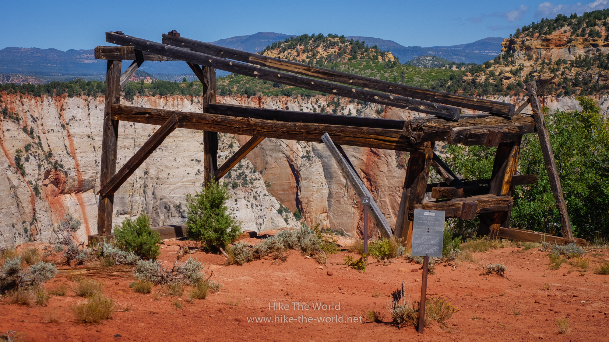
Why is this mountain called “Cable Mountain”? In the beginning of the 20th century lumber was collected on the East Rim and had to get down into the main canyon. Therefore a construction was built to transport it from the rim down into the canyon. Using old fashioned transport with horses around the canyon, this would have taken at least 3 days and might have taken even up to 10 days. In 1901 David Flanigan from Springdale created a cablework which would take the logs in about 2 minutes from the East Rim down into the 2000 ft (200 m) lower main canyon.
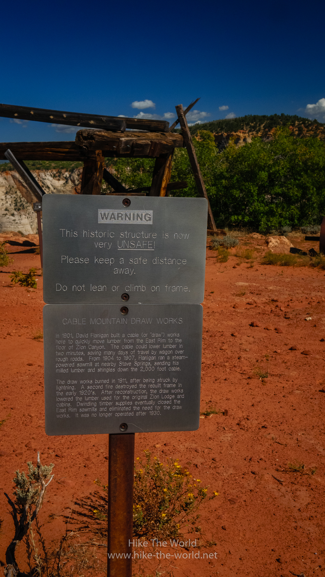
In 1911 the cableworks was destroyed by a fire induced by lightning. The new cable works was destroyed by a second fire in the early 1920s and was recreated once again. It was in use up until 1930 and sometimes even transported humans.
Today not much is left of this cableworks, only some logs are left. A sign informs you, that it’s not stable and you shouldn’t climb on it. Seeing the cableworks should already tell you, that you shouldn’t climb on it.
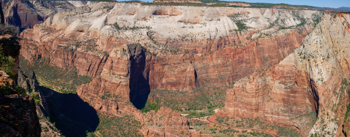
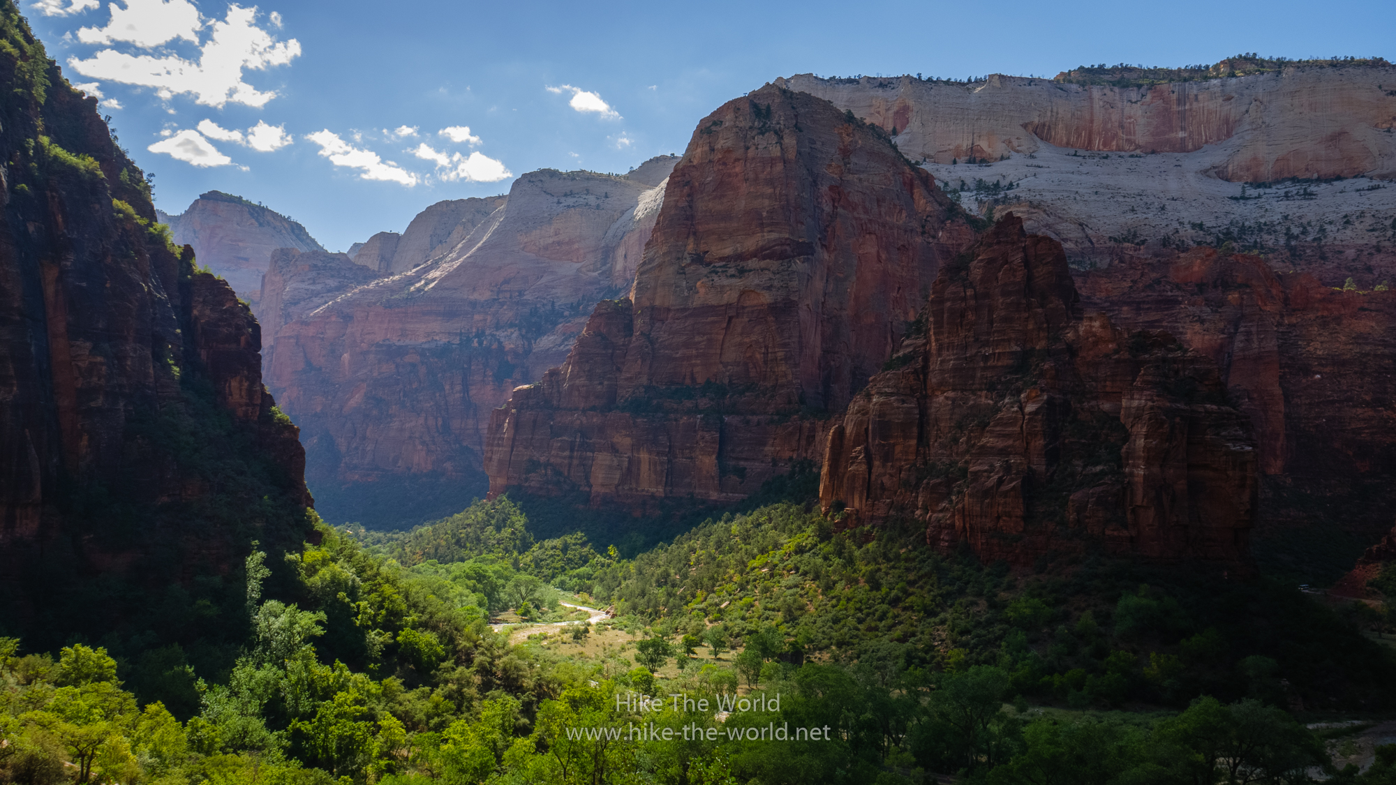
Another reason, why you really should hike Cable Mountain is the view into the canyon itself. From here you can see nearly the full canyon and have a great view of Angel’s Landing. In the Autumn of 2019 Angel’s Landing was actually closed, a thunderstorm destroyed parts of the trail up to Angel’s Landing. It was re-opened in beginning of October.

Another View from Cable Mountain shows the Echo Canyon and the Observation Point Trail. The East Rim Trail continues through the Echo Canyon and afterwards joins the Observation Point Trail. If you have time, you have the chance to hike the Observation Point, the highest point inside Zion Canyon.


Back on the East Rim Trail
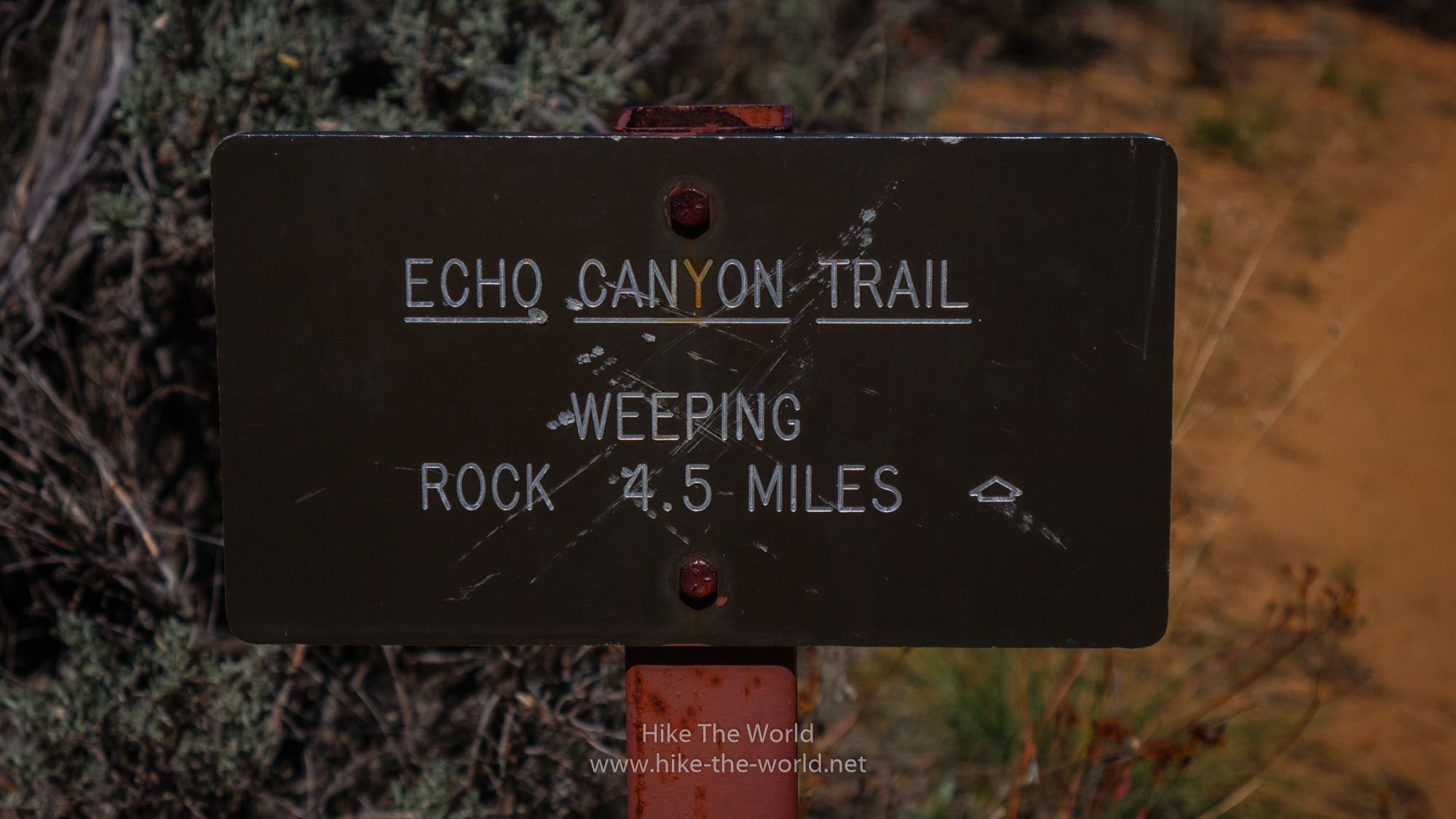
Getting back to the East Rim Trail is easy, you just have to follow the Trail you took to get to Cable Mountain and you’ll get back towards Stave Springs. Back in the 1920 there was a Lumber Mill at Stave Springs, today nothing is left. From here the trails continues via Echo Canyon to Weeping Rock. After some time, there’s a sign, telling you it’s only 4.5 miles (7 km) to Weeping Rock.
The beginning is still quite easy, you go up, you go down. Once you’ll reach Echo Canyon, you’re on the hardest part of the East Rim Trail.
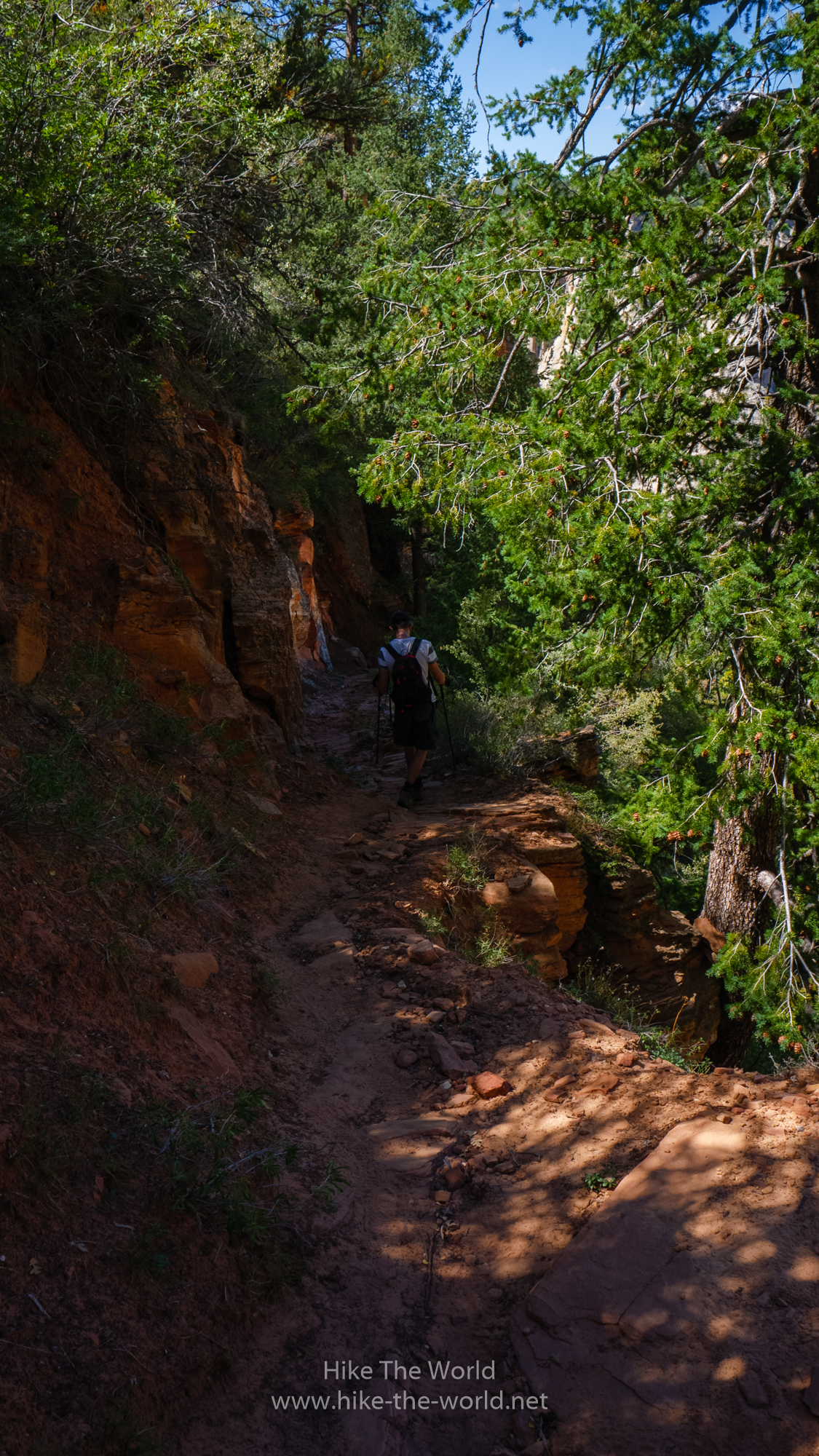
Inside Echo Canyon the trail becomes more stony with a lot of loose gravel. Stefan was the only one with hiking poles, I actually had recommended, but I didn’t buy them – what a fool I was! Additionally the sun got stronger and I got problems. By now, you know, that I’m quite a clever guy and can probably guess my problem: I didn’t have a hat! Two mistakes on one day, that shouldn’t happen to me a second time. I mean, Lessons Learned…
Due to these reasons, the hike got way more strenuous for me. Nevertheless, I tried to enjoy the Echo Canyon and every once in a while you’ll get gorgeous views on the mountains of Zion Canyon.
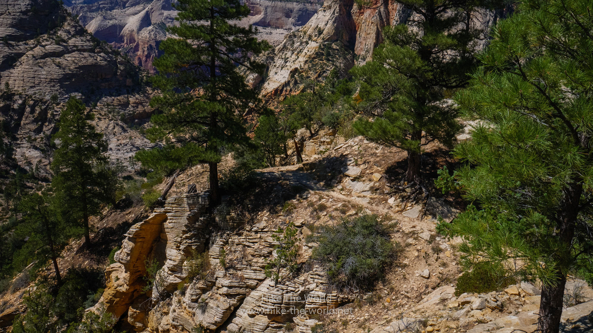
Once we left Echo Canyon, we had to decide on how to continue: Go right towards Observation Point or go left directly to Weeping Rock. Because of my light sunstroke the decision was easy: Go directly back to Weeping Rock. Although I really wanted to hike to Observation Point, but in the end it’s better to be safe. And I probably wouldn’t have made it up there.
Instead of seeing the panorama from Observation Point, we got another gorgeous view of Zion Canyon right below of Observation Point. Once we reached the Weeping Rock, we took the next Shuttle in Zion and drove to the Zion Lodge. After getting something to eat and drink, I felt way better. As a lessons learned, I bought a hat which was in regular use for the next couple of weeks.


Although I had my problems on the hike, I never regreted doing it. All in All it’s been a really great hike, it was fun and I’d do it again every time! In total we did about 15 miles (24 km) in about 8 hours, including all breaks.
Back in 2017 I already did the West Rim Trail. Comparing these both trails, the West Rim is a bit more awesome and if you have to choose between those two trails, take the West Rim. Overall I like the West Rim more. But if you have the time to do both trails, do it! Even if you have to wait a year or longer, it’s very much worth it.
Lessons learned from this hike:
1) Don’t forget your sunscreen
2) Get some hiking poles for the next year
3) Take enough food
4) Buy a hat


You May Also Like
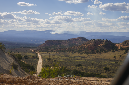
On the road in the Grand Staircase – Day 9 – 22.09.2018
Roadtrip USA 2018